
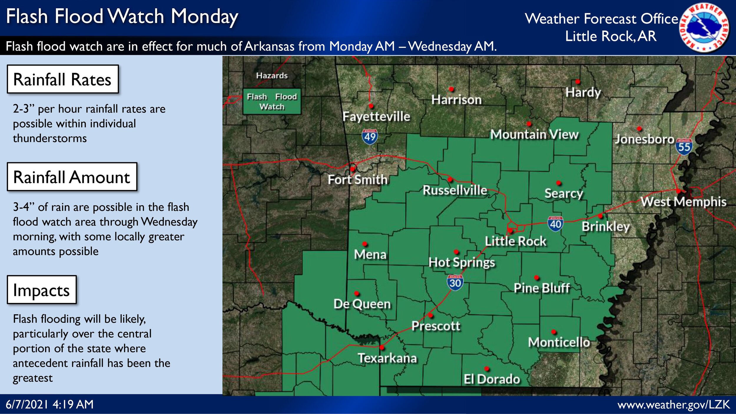
FLASH FLOOD WATCH IN EFFECT FROM 7 AM CDT THIS MORNING THROUGH
TUESDAY MORNING...

The National Weather Service in Shreveport has issued a

* Flash Flood Watch for portions of Arkansas...northwest Louisiana...
  southeast Oklahoma and northeast Texas, including the following
  areas, in Arkansas, Columbia, Hempstead, Howard, Lafayette, Little
  River, Miller, Nevada, Sevier and Union. In northwest Louisiana,
  Bossier, Caddo, Claiborne and Webster. In southeast Oklahoma,
  McCurtain. In northeast Texas, Bowie, Camp, Cass, Cherokee,
  Franklin, Gregg, Harrison, Marion, Morris, Panola, Red River,
  Rusk, Smith, Titus, Upshur and Wood.

* From 7 AM CDT this morning through Tuesday morning

* Rainfall totals of 2 to 3 inches, with isolated higher amounts
  possible. Rain amounts may occur in a short period of time and may
  impact locations that have seen heavy rainfall over the last few
  days.

* Flooding may occur in urban and poor drainage areas.  Heavy
  rainfall may also cause flooding of creeks, streams, and rivers.

PRECAUTIONARY/PREPAREDNESS ACTIONS...

A Flash Flood Watch means that conditions may develop that lead to
Flash Flooding. Flash Flooding is a very dangerous situation. You
should monitor later forecasts and be prepared to take action should
Flash Flood Warnings be issued.

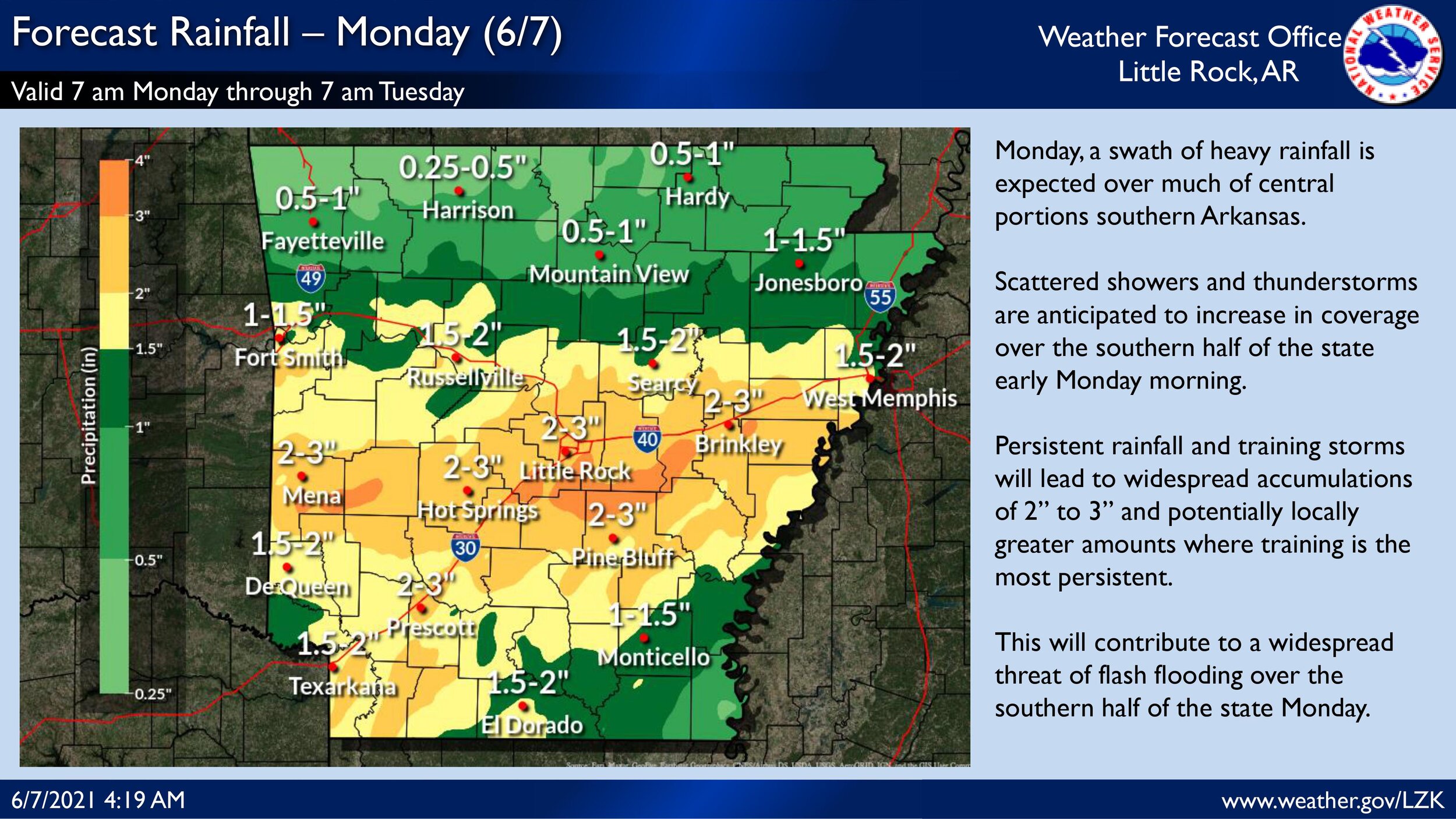
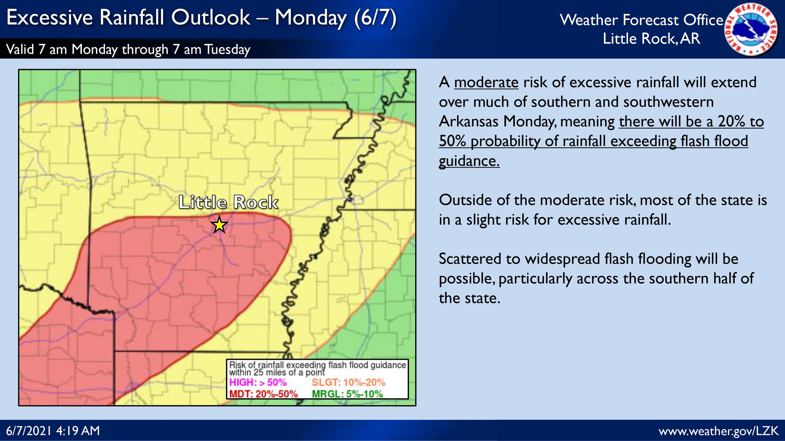
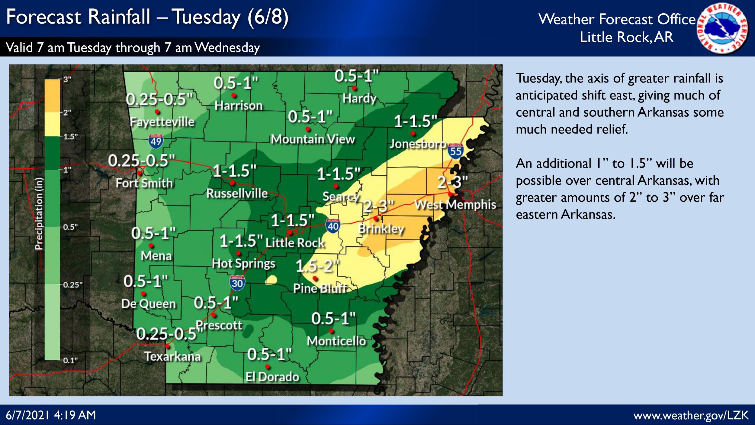

We are expecting an active day across the state regarding heavy rainfall and flash flooding potential. With the morning forecast package, the Weather Prediction Center introduced a Moderate risk of excessive rainfall for much of southwest and central Arkansas. The potential 2 to 3 inches of rain over the risk area with some locally greater amounts coupled with antecedent heavy rainfall the last few days has led to a compromised soil surface and increased flash flooding vulnerability. Please see the attached briefing for more in depth information regarding flash flooding potential over the next few days.