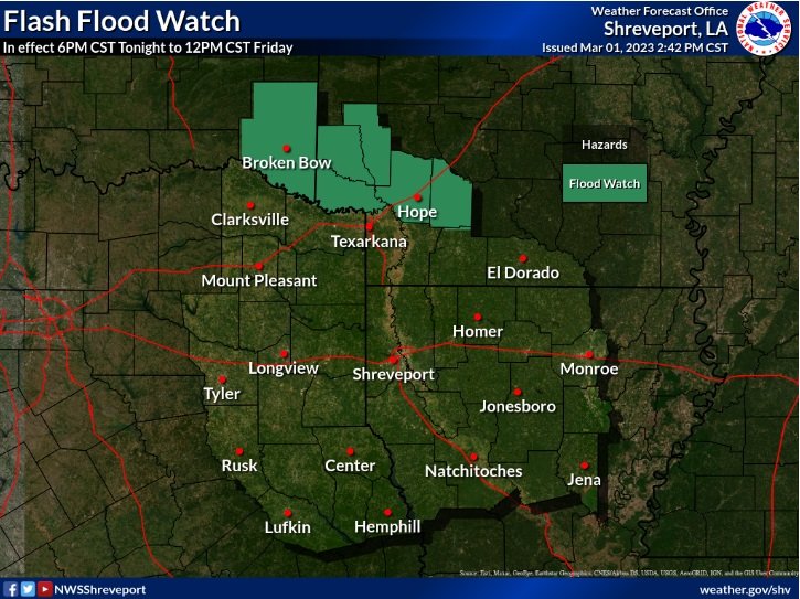
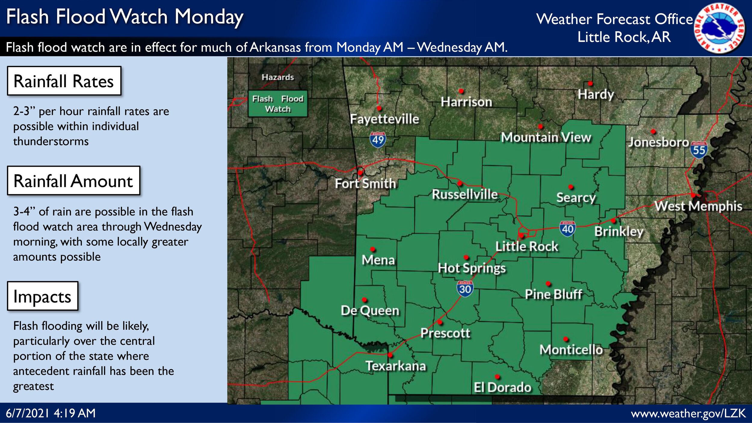
...FLASH FLOOD WATCH NOW IN EFFECT THROUGH THIS EVENING...
The Flash Flood Watch is now in effect for
* Portions of southwest Arkansas...Louisiana...southeast Oklahoma
and Texas, including the following areas, in southwest Arkansas,
Columbia, Hempstead, Howard, Lafayette, Little River, Miller,
Nevada and Sevier. In Louisiana, Bienville, Bossier, Caddo,
Claiborne, De Soto, Grant, Jackson, Lincoln, Natchitoches, Red
River, Sabine, Webster and Winn. In southeast Oklahoma, McCurtain.
In Texas, Angelina, Bowie, Camp, Cass, Cherokee, Franklin, Gregg,
Harrison, Marion, Morris, Nacogdoches, Panola, Red River, Rusk,
Sabine, San Augustine, Shelby, Smith, Titus, Upshur and Wood.
* Through this evening
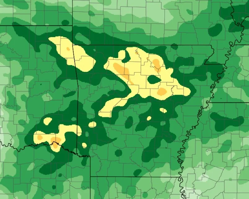
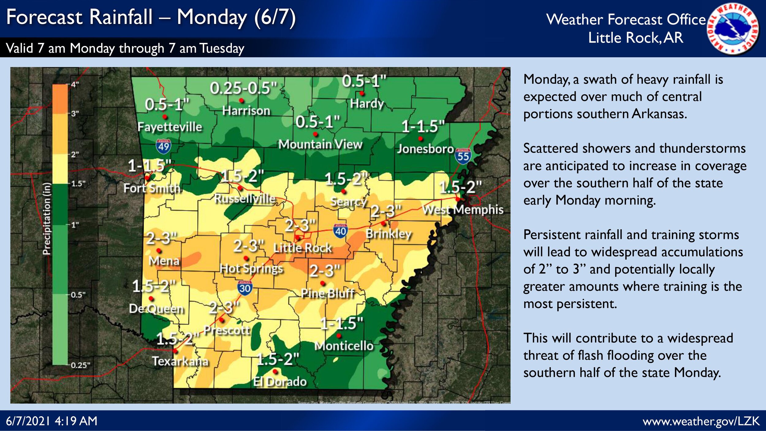
* Rainfall totals of 1 to 3 inches, with isolated higher amounts
possible.
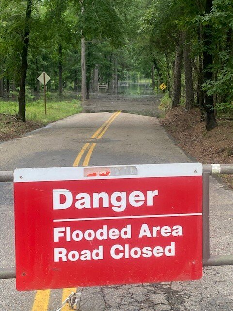
* Flooding may occur in urban and poor drainage areas. Heavy
rainfall may also cause flooding of creeks, streams, and rivers.
PRECAUTIONARY/PREPAREDNESS ACTIONS...
A Flash Flood Watch means that conditions may develop that lead to
Flash Flooding. Flash Flooding is a very dangerous situation. You
should monitor later forecasts and be prepared to take action should
Flash Flood Warnings be issued.
...The Flood Warning continues for the following river in Oklahoma... Arkansas...
Little River At Horatio affecting McCurtain, Sevier, Little River and Howard Counties.
PRECAUTIONARY/PREPAREDNESS ACTIONS... Do not drive cars through flooded areas. Caution is urged when walking near riverbanks. Turn around, don`t drown when encountering flooded roads. Most flood deaths occur in vehicles. A Flood Warning means that flooding is imminent or occurring. All interested parties should take necessary precautions immediately.
For more hydrologic information, copy and paste the following website address into your favorite web browser URL bar: water.weather.gov/ahps2/index.php?wfo=shv
902 AM CDT Fri May 21 2021 ...The Flood Warning is now in effect until tomorrow afternoon...
The Flood Warning continues for the Little River At Horatio.
* Until Saturday afternoon.
* At 8:00 AM CDT Friday the stage was 27.6 feet.
* Flood stage is 27 feet.
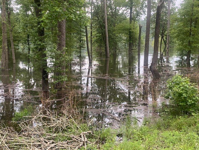
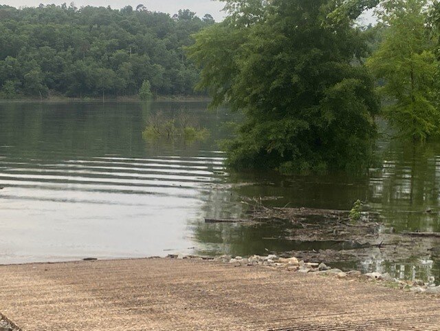
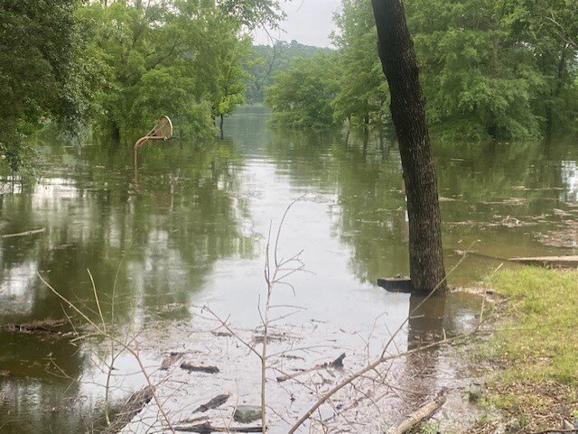
* Minor flooding is occurring and minor flooding is forecast.
* Recent Activity...The maximum river stage in the 24 hours ending at 8:00 AM CDT Friday was 28.5 feet.
* Forecast...The river is expected to fall below flood stage late this Friday evening and continue falling to 20.9 feet Wednesday morning.
* Impact...Minor lowland flooding to diminish and end through late this Friday evening