A line of strong to possibly severe thunderstorms is expected to move into western Arkansas Monday night ahead of an advancing cold front. Some of these storms could produce damaging wind gusts, and perhaps an isolated tornado.
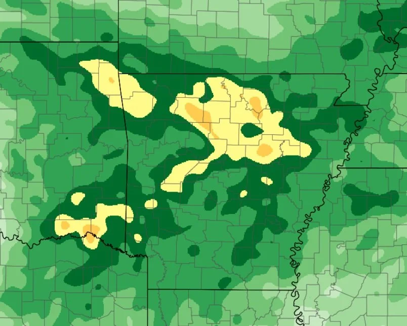
Heavy rainfall has already fallen across a good portion of central, western, and northern Arkansas over the last 24-hours. Additional heavy rainfall and severe weather will be possible through Tuesday (election day). Here is an in-depth briefing explaining expected weather conditions through Wednesday morning.
Widespread rain fell yesterday and overnight leading to flooding across portions of northern Arkansas.
Additional rainfall is expected today and into Tuesday as a cold front begins to push towards the state.
An additional one to three inches will be possible through Tuesday


