After activity comes to an end this morning, some additional thunderstorms could develop across central into southeast Arkansas this evening into tonight. But, the severe weather threat with this activity remains low.
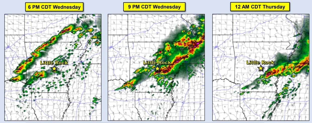
The greatest risk of severe storms in Arkansas will be on Wednesday during the evening into the overnight hours.
Chances for severe weather will increase Wednesday as a storm system tracks from the southern Plains to the mid-Mississippi Valley, and drags a cold front into Arkansas. Ahead of the front, well above average temperatures and humid conditions will create a very unstable environment.
All modes of severe weather are in play. Very large hail up to baseball size and wind gusts up to 80 mph are the main threats, with tornadoes also possible. Heavy downpours may lead to localized flash flooding as well.

