

Winter Storm Warnings continue across the vast majority of Arkansas through the Thursday-Friday (January 9-10) timeframe. A Winter Weather Advisory is posted in the far southeast. The Winter Storm Warning area currently encompasses where the highest confidence for impactful conditions exist.
NWS issues a Winter Storm Warning for southern and central Arkansas

Portions of the Winter Storm Watch have been upgraded to a Winter Storm Warning, valid through the Thursday-Friday (January 9-10) timeframe. The Winter Storm Warning area currently encompasses where the highest confidence for impactful conditions exist. Changes and expansions to the watch and warning areas are still possible and should be expected!
WHAT HAS CHANGED: Portions of the Winter Storm Watch have been upgraded to a Winter Storm Warning, mainly including the southern half of the state (south of I-40). This largely includes where confidence of impactful snowfall is currently highest. Expansions of the warning are still possible!
WHAT WE KNOW: A strong storm system is forecast to impact Arkansas Thursday morning through Friday evening bringing heavy snow across much of the state. Greatest confidence for impacts will be across west-central to central Arkansas.
WHAT WE DON’T KNOW: Exact placement of greatest snow amounts, and where locally greater totals could occur due to banding. Where snow may change over to sleet, freezing rain, or just rain near the Louisiana border. Expect changes and refinement to the forecast!
Winter weather advisories, winter storm warnings, and ice storm warnings across Arkansas; ice affecting travel, trees, and power lines

If you must travel, keep an extra flashlight, food, and water in
your vehicle in case of an emergency. Prepare for possible power
outages.

The latest road conditions for the state you are calling from can
be obtained by calling 5 1 1.

Winter Storm Warning in effect for McCurtain County in Southeastern Oklahoma; Winter Weather Advisory for Sevier and Howard Counties in SW Arkansas
A Winter Storm Warning is in effect for McCurtain County, Oklahoma. A Winter Weather Advisory is also in effect N of I-30 by mid afternoon through tonight. Snow accumulations will be slushy to start, with slush and snow-covered roads becoming slick into the evening hours.


Winter weather on the way to Arkansas; winter storm warning and winter weather advisory issued

Here is the latest update for the Winter Storm expected Tuesday through Wednesday.
We've slightly increased snowfall amounts across western and northwestern Arkansas.
Also, the Winter Storm Warning and Winter Weather Advisory have been issued.
Changes to snow amounts/coverage of accumulation are still possible, but overall confidence for impactful snowfall is high.
Ice Accumulations Expected With Winter Storm Warning in Arkansas

A winter storm with significant snow and ice accumulations is imminent! Additionally, a very cold Arctic air mass will move into the state late this week with minimum temperatures in the single digits to low 20s and wind chills in the single digits. - National Weather Service
With An Additional 2 1/4 inches, Total Snow/Sleet Accumulation Was 9 3/4 Inches in De Queen

The Winter Storm Warning for Southwest Arkansas has expired and the National Weather Service says we can expect a slow warming trend for the next several days with high temperatures back up into the lower 60’s for the middle part of next week.
Arkansas Utilities Call For People To Conserve Energy Or Face Planned Outages
By ALEXANDRIA BROWN & MICHAEL HIBBLEN
Arkansas utility companies are asking people to conserve electricity usage as the state braces for another round of winter weather. Companies say heavy snowfall and unusually cold temperatures have prompted many consumers to use a substantial amount of natural gas and electricity to stay warm in their homes.
Melody Daniel, a spokeswoman for the Arkansas Division of Emergency Management, says lowering thermostats to within the 60 to 65 degree temperature range will help conserve power.
"Heating sources are the biggest draw during these extended cold weather events," Daniel said. "So, if you’re able to reduce that by about five degrees or so, and then bundle up, wear a few extra layers and maybe have a blanket with you, that is just one simple step that most Arkansans can take that will drastically reduce the load on the power grid and help our electricity stay on."

Entergy Arkansas worker Jason Penny addresses a problem on a power line Sunday in west Little Rock.
CREDIT ENTERGY ARKANSAS
Additional Snow From Second Winter Storm Continues to Top Roadways

Snow-covered Road near De Queen Lake Wednesday morning, 02/17/21 - Photo by Jon Bunyard
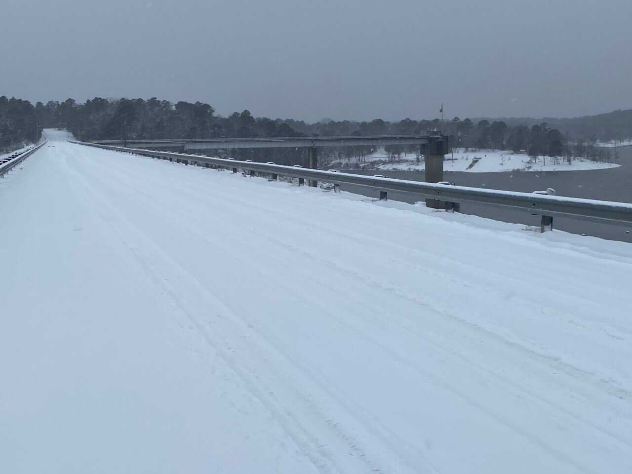
De Queen Lake Road at De Queen Dam Wednesday Morning, 02/17/21 - Photo by Jon Bunyard
Winter Storm Warning Continues Through Thursday Morning; Slow Warming Trend to Follow

...Conditions to Deteriorate as Winter Storm Approaches...

.A significant winter storm producing a mix of snow, sleet, and
freezing rain to threaten the region today and not totally ending
until during the day Thursday. Wintry precipitation is expected
to be primarily snow along and north of Interstate 30, a mix of
snow, sleet and freezing rain around the Interstate 20 corridor,
and primarily freezing rain over Deep East Texas and Central
Louisiana. Power outages will be a risk in all areas, but
especially where freezing rain will be predominant. Of course
travel remains difficult in most of the region and any recent
improvement will be lost once this new event sets in. Temperatures
will not be nearly as cold as the last 24 hours, but will remain
well below normal.

...WINTER STORM WARNING REMAINS IN EFFECT UNTIL NOON CST
THURSDAY...

* WHAT...Heavy mixed precipitation expected. Total snow
  accumulations of up to 6 inches across southwest Arkansas and
  ice accumulations of around one half of an inch south of I-20.

* WHERE...Portions of north central and northwest Louisiana,
  southeast Oklahoma, south central and southwest Arkansas and
  east and northeast Texas.

* WHEN...Until noon CST Thursday.

* IMPACTS...Power outages and tree damage are likely due to the
  ice. Travel could be nearly impossible. The hazardous
  conditions could impact the morning or evening commute.

PRECAUTIONARY/PREPAREDNESS ACTIONS...

If you must travel, keep an extra flashlight, food, and water in
your vehicle in case of an emergency.

The latest road conditions for the state you are calling from can
be obtained by calling 5 1 1.
Today
Snow. High near 28. Wind chill values as low as 10. East wind around 5 mph. Chance of precipitation is 80%. Total daytime snow accumulation of 2 to 4 inches possible.
Tonight
A slight chance of snow, mixing with sleet after 9pm, then gradually ending. Cloudy, with a low around 22. Northeast wind around 5 mph. Chance of precipitation is 20%.
Thursday
Mostly cloudy, with a high near 32. North wind 5 to 10 mph.
Thursday Night
Partly cloudy, with a low around 10. North wind around 5 mph.
Friday
Sunny, with a high near 37. Calm wind becoming southwest around 5 mph in the afternoon.
Friday Night
Partly cloudy, with a low around 17.
Saturday
Mostly sunny, with a high near 44.
Saturday Night
Mostly cloudy, with a low around 33.
Sunday
A 20 percent chance of showers after noon. Mostly cloudy, with a high near 50.
Sunday Night
A 20 percent chance of showers before midnight. Partly cloudy, with a low around 29.
Monday
Sunny, with a high near 56.
Monday Night
Mostly clear, with a low around 31.
Tuesday
Sunny, with a high near 61.
UA Cossatot - All Campuses Will Be Closed Through the Rest of the Week; Another Winter Storm on the Way
“Due to the continuing dangerous road conditions in the area and the possibility of another extended winter storm all UA Cossatot campuses will be closed for the rest of this week (Wednesday, February 16th, Thursday, February 17th, and Friday, February 18th). UA Cossatot fully expects to be open under normal hours on Monday, February 22nd.”
Dr. Steve Cole
Chancellor
UA Cossatot

Winter Storm Warning On The Way For Tonight Through Thursday Noon
...Next winter storm will push into our area tonight and
continue through Thursday morning...

...WINTER STORM WARNING REMAINS IN EFFECT FROM 6 PM THIS EVENING
TO NOON CST THURSDAY...
...WIND CHILL ADVISORY IS CANCELLED...

* WHAT...A wintry mix of snow, sleet, and freezing rain. Snow and
  sleet accumulations will range from less than 2 inches south of
  the I-20 corridor to 5 to 8 inches north of the I-30 corridor.
  Ice accumulations of a quarter of an inch to a half of an inch
  with localized higher amounts will be possible from Deep East
  Texas across northwestern Louisiana, central Louisiana, and into
  south- central Arkansas.

* WHERE...Portions of north central and northwest Louisiana,
  southeast Oklahoma, south central and southwest Arkansas and
  east and northeast Texas.

* WHEN...From 6 PM this evening to noon CST Thursday.

* IMPACTS...Treacherous road conditions will continue across the
  region. Locations with over a quarter inch of ice will see
  downed limbs and powerlines which will lead to the possibility
  of widespread power outages. Cold temperatures will continue to
  make extended time outdoors dangerous with the risk of
  hypothermia.

PRECAUTIONARY/PREPAREDNESS ACTIONS...

If you must travel, keep an extra flashlight, food, and water in
your vehicle in case of an emergency.

The latest road conditions for the state you are calling from can
be obtained by calling 5 1 1.
Tonight
Snow, mainly after 9pm. Low around 18. Wind chill values as low as 10. Southeast wind around 5 mph. Chance of precipitation is 80%. New snow accumulation of 1 to 3 inches possible.
Wednesday
Snow before noon, then snow, freezing rain, and sleet. High near 28. Wind chill values as low as 9. Northeast wind around 5 mph. Chance of precipitation is 90%. Little or no ice accumulation expected. New snow and sleet accumulation of 3 to 5 inches possible.
Wednesday Night
A slight chance of snow showers and freezing rain before midnight. Cloudy, with a low around 21. Northeast wind around 5 mph. Chance of precipitation is 20%.
Thursday
Mostly cloudy, with a high near 37. North wind 5 to 10 mph.
Thursday Night
Partly cloudy, with a low around 11.
Friday
Sunny, with a high near 38.
Friday Night
Partly cloudy, with a low around 17.
Saturday
Mostly sunny, with a high near 44.
Saturday Night
Mostly cloudy, with a low around 33.
Sunday
A 30 percent chance of showers. Mostly cloudy, with a high near 52.
Sunday Night
A 30 percent chance of showers. Mostly cloudy, with a low around 32.
Monday
Mostly sunny, with a high near 57.
All UA Cossatot Campuses Closed Monday Due to Forecasted Inclement Winter Weather in Southwest Arkansas

Snow Picture of the Leeper Building at UA Cossatot De Queen Sunday Morning 02/14/21
"Due to the expected storm conditions expected this weekend and to start the work week, all UA Cossatot campuses will be closed Monday, February 15th." Dr. Steve Cole, Chancellor, UA Cossatot
The Latest Briefing on Winter Weather and Warnings for Arkansas from the National Weather Service

Click on photo above for the Winter Weather Briefing from the National Weather Service.
Winter Storm Warning, Hard Freeze Warning and Wind Chill Advisory Issued from the National Weather Service
Sevier-Howard-Little River-Hempstead-Nevada-Miller-Lafayette- Columbia-Union-Caddo-Bossier-Webster-Claiborne-Lincoln-De Soto- Red River-Bienville-Jackson-Ouachita-Sabine-Natchitoches-Winn- Grant-Caldwell-La Salle-McCurtain-Bowie-Franklin-Titus-Camp- Morris-Cass-Wood-Upshur-Marion-Smith-Gregg-Harrison-Cherokee-Rusk- Panola-Nacogdoches-Shelby-Angelina-San Augustine- Including the cities of De Queen, Nashville, Mineral Springs, Dierks, Ashdown, Hope, Prescott, Texarkana, Stamps, Lewisville, Bradley, Magnolia, El Dorado, Shreveport, Bossier City, Minden, Springhill, Homer, Haynesville, Ruston, Farmerville, Bernice, Mansfield, Stonewall, Logansport, Coushatta, Martin, Arcadia, Ringgold, Gibsland, Jonesboro, Monroe, Many, Zwolle, Pleasant Hill, Natchitoches, Winnfield, Colfax, Montgomery, Dry Prong, Clarks, Grayson, Columbia, Jena, Midway, Olla, Idabel, Broken Bow, Clarksville, Bogata, Mount Vernon, Mount Pleasant, Pittsburg, Daingerfield, Lone Star, Naples, Omaha, Atlanta, Linden, Hughes Springs, Queen City, Mineola, Winnsboro, Quitman, Hawkins, Gilmer, Big Sandy, Jefferson, Tyler, Longview, Marshall, Jacksonville, Rusk, Henderson, Carthage, Nacogdoches, Center, Lufkin, San Augustine, Hemphill, and Pineland 223 AM CST Sun Feb 14 2021

...WINTER STORM WARNING REMAINS IN EFFECT UNTIL 6 PM CST MONDAY... ...WIND CHILL ADVISORY REMAINS IN EFFECT FROM MIDNIGHT TONIGHT TO 6 PM CST MONDAY...
* WHAT...For the Winter Storm Warning, heavy mixed precipitation expected. Total snow accumulations of 3 to 5 inches possible across deep east Texas into northwest Louisiana and south- central Arkansas with lesser amounts elsewhere. Sleet accumulations of around 1 inch and ice accumulations of around one quarter of an inch possible across north-central and northeast Louisiana. For the Wind Chill Advisory, very cold wind chills expected. Wind chills as low as 5 below zero across southeast Oklahoma and in the single digits elsewhere.
* WHERE...Portions of north central and northwest Louisiana, southeast Oklahoma, south central and southwest Arkansas and east and northeast Texas.
* WHEN...For the Winter Storm Warning, through 6 PM CST Monday. For the Wind Chill Advisory, through 6 PM CST Monday.
* IMPACTS...Power outages and tree damage are likely due to the ice. Travel could be nearly impossible due to snow, sleet, and ice accumulations. The cold wind chills could result in hypothermia if precautions are not taken.
PRECAUTIONARY/PREPAREDNESS ACTIONS... If you must travel, keep an extra flashlight, food, and water in your vehicle in case of an emergency. Use caution while traveling outside. Wear appropriate clothing, a hat, and gloves. The latest road conditions for the state you are calling from can be obtained by calling 5 1 1.
...HARD FREEZE WARNING REMAINS IN EFFECT FROM MIDNIGHT TONIGHT TO 6 AM CST TUESDAY...
* WHAT...Sub-freezing temperatures on Sunday night to range anywhere from single digits across Southeast Oklahoma to near 20 degrees across East Texas and North-Central Louisiana. On Monday night, temperatures are forecast to fall into the single digits areawide.
* WHERE...Portions of north central and northwest Louisiana, southeast Oklahoma, south central and southwest Arkansas and east and northeast Texas.
* WHEN...From midnight tonight to 6 AM CST Tuesday.
* IMPACTS...Hard freeze conditions will kill crops, other sensitive vegetation and possibly damage unprotected outdoor plumbing.
PRECAUTIONARY/PREPAREDNESS ACTIONS... Take steps now to protect tender plants from the cold. To prevent freezing and possible bursting of outdoor water pipes they should be wrapped, drained, or allowed to drip slowly. Those that have in-ground sprinkler systems should drain them and cover above- ground pipes to protect them from freezing.
Detailed Forecast for SW Arkansas from the National Weather Service:
Sunday
Snow likely before noon, then snow and sleet likely between noon and 3pm, then snow likely after 3pm. Cloudy, with a high near 26. Wind chill values as low as 11. Northeast wind around 10 mph. Chance of precipitation is 60%. Total daytime snow and sleet accumulation of less than a half inch possible.
Sunday Night
Snow. Low around 11. Wind chill values as low as 4. North wind 5 to 10 mph. Chance of precipitation is 90%. New snow accumulation of 3 to 5 inches possible.
Monday President’s Day
A 20 percent chance of snow before noon. Partly sunny and cold, with a high near 22. Wind chill values as low as zero. North wind 5 to 10 mph.
Monday Night
Partly cloudy, with a low around 3. Northwest wind around 5 mph becoming calm in the evening.
Tuesday
Partly sunny, with a high near 29. Calm wind becoming southeast around 5 mph in the afternoon.
Tuesday Night
A slight chance of snow showers before midnight, then a chance of snow and freezing rain. Cloudy, with a low around 19. Chance of precipitation is 50%.
Wednesday
Snow and sleet before noon, then snow and freezing rain. High near 28. Chance of precipitation is 90%.
Wednesday Night
Snow, freezing rain, and sleet likely, mainly before midnight. Cloudy, with a low around 24. Chance of precipitation is 60%.
Thursday
A 30 percent chance of snow showers, mainly before noon. Mostly cloudy, with a high near 34.
Thursday Night
Partly cloudy, with a low around 10.
Friday
Sunny, with a high near 39.
Friday Night
Partly cloudy, with a low around 22.
Saturday
Mostly sunny, with a high near 48.