Southwest Arkansas

Summer Jobs Open

SUMMER EMPLOYMENT OPPORTUNITY!

Husqvarna, L&G facility, is currently accepting high school and college student applications for employment during the summer months on second shift. Pay range $15.25- $17.00 per hour. Students must meet the minimum age requirement.

When applying, write "SUMMER" at the top of the application.

Students can apply online through Facebook and/or Indeed. If they want to come in person we are having our Student Program Open House/Job Fair next Saturday, May 8th, from 10:00 – 12:00 p.m. They will get a plant tour, and we will have refreshments for them while they fill out their application.

Interested applicants may apply at:

Husqvarna

1 Poulan Drive

Nashville, AR

summer work.jpg

UA Cossatot to Host Fiesta Fest May 1 in Downtown De Queen

PRESS RELEASE

183 College Drive, De Queen, AR 71832

870-584-1124

www.cccua.edu

FOR IMMEDIATE RELEASE: 01 April 2021

CONTACT: Dustin Roberts, Director of Development

UA Cossatot to Host Fiesta Fest in Downtown De Queen

UA Cossatot will host Fiesta Fest on Saturday, May 1, 2021, in Downtown De Queen on North 3rd Street and West De Queen Avenue in front of the Courthouse from 1:00 PM until 9:00 PM.

The festival’s focus is bringing the community together to celebrate the cultures of Southwest Arkansas while raising scholarship money for UA Cossatot students.

Festivities will include food, vendors, live music, a DJ and light show, folkloric dancing, carnival rides, games, inflatables, and more.

“It a great time for all of us to come together for a common cause to celebrate the cultures that make up our community and help provide students of the college with an opportunity to benefit from the money that is raised from this event. These scholarships will help students complete their degree at the college,” said Director of the Center for Student Success, Erika Buenrrotro.

To become a sponsor or vendor for Fiesta Fest, contact Dustin Roberts, Director of Development, at droberts@cccua.edu or 870-584-1172. ###

Thursday COVID-19 Update from AR Dept of Health

In its Wednesday update, the Arkansas Department of Health reported 212 new cases; 1,695 active cases; 166 hospitalized, which is down 4 from Tuesday; 27 on ventilators, which is up 2 from Tuesday; deaths added today, 10, for a total of 5,626; a total of 330,398 cases; 253,685 recoveries; PCR tests, 5,767; antigen tests, 1,120.

The Health Department reported that the top counties for new cases are Benton, 34; Pulaski, 26; Washington, 16; Faulkner, 14; and Sebastian, 13.

Governor Hutchinson released the following statement on today’s COVID-19 numbers:

“The total number of vaccine doses administered since last week has increased by over 141,000. We also have over 61,000 additional Arkansans who are fully vaccinated. These numbers are encouraging, and with all Arkansans 16 and older eligible to receive the vaccine, we hope these numbers will continue to increase.”

Here are today's COVID-19 statewide numbers:

210331_COVID-19_update.jpg

Here are today's COVID-19 vaccine statewide numbers:

210331_COVID-19_vaccine_update.jpg

Active Cases Data for Sevier County
Total Active Cases: 0
Active Confirmed Cases:
Active Probable Cases:

Active Cases Data for Howard County
Total Active Cases: 4
Active Confirmed Cases: 1
Active Probable Cases: 3

Active Cases Data for Little River County
Total Active Cases: 8
Active Confirmed Cases: 6
Active Probable Cases: 2

Active Cases Data for Polk County
Total Active Cases: 3
Active Confirmed Cases: 1
Active Probable Cases: 2

Active Cases Data for Pike County
Total Active Cases: 1
Active Confirmed Cases: 1
Active Probable Cases:

Tuesday's COVID-19 Update from the AR Dept of Health

In its Monday update, the Arkansas Department of Health reported 117 new cases; 2,863 active cases; 250 hospitalized, which is up 7 from Sunday; 58 on ventilators, which is up 3 from Sunday; deaths added today, 7, for a total of 5,481; a total of 327,060 cases; 250,717 recoveries; PCR tests, 2,313; antigen tests, 138.

The Health Department reported that the top counties for new cases are Benton, 15; Crawford, 13; Pulaski, 12; Washington, 11; and Lonoke, 8.

Governor Hutchinson released the following statement on today’s COVID-19 numbers:

“Today's number of active cases is the lowest in Arkansas since early June. We are making great progress in decreasing our new case numbers, but we must continue to get vaccinated. The best thing each of us can do is get the vaccine when it's our turn.”

COVID_19_numbers_3_15_21_(1).png
210315_COVID-19_vaccine_update.png

COVID-19 Metrics for Sevier County
Total Active Cases: 32
Active Confirmed Cases: 12
Active Probable Cases: 20

COVID-19 Metrics for Howard County
Total Active Cases: 11
Active Confirmed Cases: 9
Active Probable Cases: 2

COVID-19 Metrics for Little River County
Total Active Cases: 15
Active Confirmed Cases: 9
Active Probable Cases: 6

COVID-19 Metrics for Polk County
Total Active Cases: 15
Active Confirmed Cases: 14
Active Probable Cases: 1

COVID-19 Metrics for Pike County
Total Active Cases: 10
Active Confirmed Cases: 7
Active Probable Cases: 3

Monday Southwest Arkansas' COVID-19 Case Numbers and Maps

COVID-19 Metrics for Sevier County
Total Active Cases: 52
Active Confirmed Cases: 6
Active Probable Cases: 46

COVID-19 Metrics for Howard County
Total Active Cases: 28
Active Confirmed Cases: 9
Active Probable Cases: 19

COVID-19 Metrics for Little River County
Total Active Cases: 13
Active Confirmed Cases: 6
Active Probable Cases: 7

COVID-19 Metrics for Polk County
Total Active Cases: 26
Active Confirmed Cases: 22
Active Probable Cases: 4

COVID-19 Metrics for Pike County
Total Active Cases: 33
Active Confirmed Cases: 23
Active Probable Cases: 10

 
COVID_19_numbers_2_28_21_(1).png
map+corona.png

Secondary Roads Across SW Arkansas Still Have Patchy Ice; Drive With Caution

Photos were taken Thursday Evening,02/18, and Friday Morning, 02/19, by Jon Bunyard
Photo 1: 9th Street, De Queen, Friday Morning
Other 2 Photos at Bellah Mine Thursday Evening

Additional Snow From Second Winter Storm Continues to Top Roadways

Snow-covered Road near De Queen Lake Wednesday morning, 02/17/21 - Photo by Jon Bunyard

Snow-covered Road near De Queen Lake Wednesday morning, 02/17/21 - Photo by Jon Bunyard

De Queen Lake Road at De Queen Dam Wednesday Morning, 02/17/21 - Photo by Jon Bunyard

De Queen Lake Road at De Queen Dam Wednesday Morning, 02/17/21 - Photo by Jon Bunyard

Winter Storm Warning Continues Through Thursday Morning; Slow Warming Trend to Follow

nws 1.png
...Conditions to Deteriorate as Winter Storm Approaches...

.A significant winter storm producing a mix of snow, sleet, and
freezing rain to threaten the region today and not totally ending
until during the day Thursday. Wintry precipitation is expected
to be primarily snow along and north of Interstate 30, a mix of
snow, sleet and freezing rain around the Interstate 20 corridor,
and primarily freezing rain over Deep East Texas and Central
Louisiana. Power outages will be a risk in all areas, but
especially where freezing rain will be predominant. Of course
travel remains difficult in most of the region and any recent
improvement will be lost once this new event sets in. Temperatures
will not be nearly as cold as the last 24 hours, but will remain
well below normal.

...WINTER STORM WARNING REMAINS IN EFFECT UNTIL NOON CST
THURSDAY...

* WHAT...Heavy mixed precipitation expected. Total snow
  accumulations of up to 6 inches across southwest Arkansas and
  ice accumulations of around one half of an inch south of I-20.

* WHERE...Portions of north central and northwest Louisiana,
  southeast Oklahoma, south central and southwest Arkansas and
  east and northeast Texas.

* WHEN...Until noon CST Thursday.

* IMPACTS...Power outages and tree damage are likely due to the
  ice. Travel could be nearly impossible. The hazardous
  conditions could impact the morning or evening commute.

PRECAUTIONARY/PREPAREDNESS ACTIONS...

If you must travel, keep an extra flashlight, food, and water in
your vehicle in case of an emergency.

The latest road conditions for the state you are calling from can
be obtained by calling 5 1 1.

Today

Snow. High near 28. Wind chill values as low as 10. East wind around 5 mph. Chance of precipitation is 80%. Total daytime snow accumulation of 2 to 4 inches possible.

Tonight

A slight chance of snow, mixing with sleet after 9pm, then gradually ending. Cloudy, with a low around 22. Northeast wind around 5 mph. Chance of precipitation is 20%.

Thursday

Mostly cloudy, with a high near 32. North wind 5 to 10 mph.

Thursday Night

Partly cloudy, with a low around 10. North wind around 5 mph.

Friday

Sunny, with a high near 37. Calm wind becoming southwest around 5 mph in the afternoon.

Friday Night

Partly cloudy, with a low around 17.

Saturday

Mostly sunny, with a high near 44.

Saturday Night

Mostly cloudy, with a low around 33.

Sunday

A 20 percent chance of showers after noon. Mostly cloudy, with a high near 50.

Sunday Night

A 20 percent chance of showers before midnight. Partly cloudy, with a low around 29.

Monday

Sunny, with a high near 56.

Monday Night

Mostly clear, with a low around 31.

Tuesday

Sunny, with a high near 61.

Hard Freeze for Tonight and More Snow Expected in Forecast from the National Weather Service

...HARD FREEZE WARNING REMAINS IN EFFECT UNTIL 6 AM CST TUESDAY...

* WHAT...Sub-freezing temperatures to fall into the single digits
  tonight.

* WHERE...Portions of north central and northwest Louisiana, south
  central and southwest Arkansas, and portions of east Texas.

* WHEN...Through 6 AM CST Tuesday.

* IMPACTS...Hard freeze conditions will kill crops, other
  sensitive vegetation and damage unprotected outdoor plumbing.

PRECAUTIONARY/PREPAREDNESS ACTIONS...

Take steps now to protect tender plants from the cold. To prevent
freezing and possible bursting of outdoor water pipes they should
be wrapped, drained, or allowed to drip slowly. Those that have
in-ground sprinkler systems should drain them and cover above-
ground pipes to protect them from freezing.

Tonight

Partly cloudy, with a low around 1. Northwest wind around 5 mph becoming calm in the evening.

Tuesday

Increasing clouds, with a high near 26. Wind chill values as low as 1. Calm wind becoming southeast around 5 mph in the afternoon.

Tuesday Night

A chance of snow showers before midnight, then snow and sleet likely. Cloudy, with a low around 19. Wind chill values as low as 11. East wind around 5 mph. Chance of precipitation is 70%.

Wednesday

Snow showers before noon, then snow showers, freezing rain, and sleet. The snow could be heavy at times. High near 29. Northeast wind 5 to 10 mph. Chance of precipitation is 100%.

Wednesday Night

Snow showers, freezing rain, and sleet likely before midnight, then a chance of snow showers. Cloudy, with a low around 23. Chance of precipitation is 60%.

Thursday

A 40 percent chance of snow showers, mainly before noon. Mostly cloudy, with a high near 33.

Thursday Night

Partly cloudy, with a low around 10.

Friday

Sunny, with a high near 38.

Friday Night

Partly cloudy, with a low around 18.

Saturday

Mostly sunny, with a high near 46.

Saturday Night

Mostly cloudy, with a low around 35.

Sunday

Mostly cloudy, with a high near 53.

Winter Storm Warning, Hard Freeze Warning and Wind Chill Advisory Issued from the National Weather Service

Sevier-Howard-Little River-Hempstead-Nevada-Miller-Lafayette- Columbia-Union-Caddo-Bossier-Webster-Claiborne-Lincoln-De Soto- Red River-Bienville-Jackson-Ouachita-Sabine-Natchitoches-Winn- Grant-Caldwell-La Salle-McCurtain-Bowie-Franklin-Titus-Camp- Morris-Cass-Wood-Upshur-Marion-Smith-Gregg-Harrison-Cherokee-Rusk- Panola-Nacogdoches-Shelby-Angelina-San Augustine- Including the cities of De Queen, Nashville, Mineral Springs, Dierks, Ashdown, Hope, Prescott, Texarkana, Stamps, Lewisville, Bradley, Magnolia, El Dorado, Shreveport, Bossier City, Minden, Springhill, Homer, Haynesville, Ruston, Farmerville, Bernice, Mansfield, Stonewall, Logansport, Coushatta, Martin, Arcadia, Ringgold, Gibsland, Jonesboro, Monroe, Many, Zwolle, Pleasant Hill, Natchitoches, Winnfield, Colfax, Montgomery, Dry Prong, Clarks, Grayson, Columbia, Jena, Midway, Olla, Idabel, Broken Bow, Clarksville, Bogata, Mount Vernon, Mount Pleasant, Pittsburg, Daingerfield, Lone Star, Naples, Omaha, Atlanta, Linden, Hughes Springs, Queen City, Mineola, Winnsboro, Quitman, Hawkins, Gilmer, Big Sandy, Jefferson, Tyler, Longview, Marshall, Jacksonville, Rusk, Henderson, Carthage, Nacogdoches, Center, Lufkin, San Augustine, Hemphill, and Pineland 223 AM CST Sun Feb 14 2021

nws 2.png

...WINTER STORM WARNING REMAINS IN EFFECT UNTIL 6 PM CST MONDAY... ...WIND CHILL ADVISORY REMAINS IN EFFECT FROM MIDNIGHT TONIGHT TO 6 PM CST MONDAY...

* WHAT...For the Winter Storm Warning, heavy mixed precipitation expected. Total snow accumulations of 3 to 5 inches possible across deep east Texas into northwest Louisiana and south- central Arkansas with lesser amounts elsewhere. Sleet accumulations of around 1 inch and ice accumulations of around one quarter of an inch possible across north-central and northeast Louisiana. For the Wind Chill Advisory, very cold wind chills expected. Wind chills as low as 5 below zero across southeast Oklahoma and in the single digits elsewhere.

* WHERE...Portions of north central and northwest Louisiana, southeast Oklahoma, south central and southwest Arkansas and east and northeast Texas.

* WHEN...For the Winter Storm Warning, through 6 PM CST Monday. For the Wind Chill Advisory, through 6 PM CST Monday.

* IMPACTS...Power outages and tree damage are likely due to the ice. Travel could be nearly impossible due to snow, sleet, and ice accumulations. The cold wind chills could result in hypothermia if precautions are not taken.

PRECAUTIONARY/PREPAREDNESS ACTIONS... If you must travel, keep an extra flashlight, food, and water in your vehicle in case of an emergency. Use caution while traveling outside. Wear appropriate clothing, a hat, and gloves. The latest road conditions for the state you are calling from can be obtained by calling 5 1 1.

...HARD FREEZE WARNING REMAINS IN EFFECT FROM MIDNIGHT TONIGHT TO 6 AM CST TUESDAY...

* WHAT...Sub-freezing temperatures on Sunday night to range anywhere from single digits across Southeast Oklahoma to near 20 degrees across East Texas and North-Central Louisiana. On Monday night, temperatures are forecast to fall into the single digits areawide.

* WHERE...Portions of north central and northwest Louisiana, southeast Oklahoma, south central and southwest Arkansas and east and northeast Texas.

* WHEN...From midnight tonight to 6 AM CST Tuesday.

* IMPACTS...Hard freeze conditions will kill crops, other sensitive vegetation and possibly damage unprotected outdoor plumbing.

PRECAUTIONARY/PREPAREDNESS ACTIONS... Take steps now to protect tender plants from the cold. To prevent freezing and possible bursting of outdoor water pipes they should be wrapped, drained, or allowed to drip slowly. Those that have in-ground sprinkler systems should drain them and cover above- ground pipes to protect them from freezing.

Detailed Forecast for SW Arkansas from the National Weather Service:

Sunday

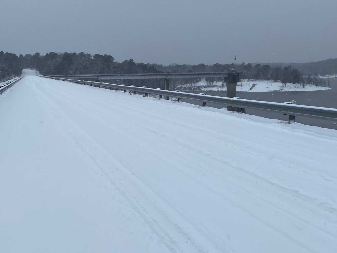
Snow likely before noon, then snow and sleet likely between noon and 3pm, then snow likely after 3pm. Cloudy, with a high near 26. Wind chill values as low as 11. Northeast wind around 10 mph. Chance of precipitation is 60%. Total daytime snow and sleet accumulation of less than a half inch possible.

Sunday Night

Snow. Low around 11. Wind chill values as low as 4. North wind 5 to 10 mph. Chance of precipitation is 90%. New snow accumulation of 3 to 5 inches possible.

Monday President’s Day

A 20 percent chance of snow before noon. Partly sunny and cold, with a high near 22. Wind chill values as low as zero. North wind 5 to 10 mph.

Monday Night

Partly cloudy, with a low around 3. Northwest wind around 5 mph becoming calm in the evening.

Tuesday

Partly sunny, with a high near 29. Calm wind becoming southeast around 5 mph in the afternoon.

Tuesday Night

A slight chance of snow showers before midnight, then a chance of snow and freezing rain. Cloudy, with a low around 19. Chance of precipitation is 50%.

Wednesday

Snow and sleet before noon, then snow and freezing rain. High near 28. Chance of precipitation is 90%.

Wednesday Night

Snow, freezing rain, and sleet likely, mainly before midnight. Cloudy, with a low around 24. Chance of precipitation is 60%.

Thursday

A 30 percent chance of snow showers, mainly before noon. Mostly cloudy, with a high near 34.

Thursday Night

Partly cloudy, with a low around 10.

Friday

Sunny, with a high near 39.

Friday Night

Partly cloudy, with a low around 22.

Saturday

Mostly sunny, with a high near 48.

Another of the 2021 Reasons for Attending UA Cossatot Next Spring - Native Americans

And now for another of our 2021 reasons to attend UA Cossatot this spring.....Reason #24....Native Americans living out-of-state, may be eligible for in-state tuition! Here in southwest Arkansas, we are proud of our Native American heritage, and members of a dozen tribes can apply for a waiver to qualify for in-state tuition at UA Cossatot. Waiver applications are available on our website at:

https://www.cccua.edu/.../NATIVE%20AMERICAN%20WAIVER...

For a complete schedule of classes, visit our website: https://www.cccua.edu/programs-of-study

The Spring 2021 semester begins Monday, January 11th!

native americans.png

New Years Eve COVID-19 Update


LITTLE ROCK – Governor Asa Hutchinson provided today's update on Arkansas's COVID-19 response.

In its Wednesday update, the Arkansas Department of Health reported 3,184 new cases; 21,853 active cases; 1,174 hospitalized, which is up 13 from Tuesday; 205 on ventilators, which is up 7 from Tuesday; deaths added today, 34, for a total of 3,637; a total of 222,430 cases; 166,198 recoveries; PCR tests, 8,843; antigen tests, 4,389.

The Health Department reported that the top counties for new cases are Pulaski, 355; Washington, 290; Benton, 278; Faulkner, 150; and Sebastian, 134.

Governor Hutchinson released the following statement on today’s COVID-19 numbers:

"We continue to see high numbers of new cases and capacity pressures on our hospitals. I urge everyone to be careful as we enter another holiday to reduce the virus spread, and we need to support each other as Arkansans while we work to distribute the vaccine."

Here are today's COVID-19 statewide numbers:

COVID_19_numbers_12_30_20.png
map corona.png
map corona world.png

COVID-19 Metrics for Sevier County
Total Cumulative Cases: 2,063
Confirmed Cases: 1,548
Probable Cases: 515
Total Active Cases: 92
Active Confirmed Cases: 35
Active Probable Cases: 57

COVID-19 Metrics for Howard County
Total Cumulative Cases: 1,097
Confirmed Cases: 797
Probable Cases: 300
Total Active Cases: 54
Active Confirmed Cases: 30
Active Probable Cases: 24

COVID-19 Metrics for Little River County
Total Cumulative Cases: 806
Confirmed Cases: 651
Probable Cases: 155
Total Active Cases: 76
Active Confirmed Cases: 60
Active Probable Cases: 16

COVID-19 Metrics for Polk County
Total Cumulative Cases: 1,243
Confirmed Cases: 1,103
Probable Cases: 140
Total Active Cases: 116
Active Confirmed Cases: 94
Active Probable Cases: 22

COVID-19 Metrics for Pike County
Total Cumulative Cases: 680
Confirmed Cases: 544
Probable Cases: 136
Total Active Cases: 114
Active Confirmed Cases: 64
Active Probable Cases: 50

Sunday's COVID-19 Update

COVID-19 Metrics for Sevier County
Total Cumulative Cases: 1,213
Confirmed Cases: 1,197
Probable Cases: 16
Total Active Cases: 10
Active Confirmed Cases: 7
Active Probable Cases: 3

COVID-19 Metrics for Howard County
Total Cumulative Cases: 503
Confirmed Cases: 476
Probable Cases: 27
Total Active Cases: 23
Active Confirmed Cases: 18
Active Probable Cases: 5

COVID-19 Metrics for Little River County
Total Cumulative Cases: 371
Confirmed Cases: 352
Probable Cases: 19
Total Active Cases: 16
Active Confirmed Cases: 15
Active Probable Cases: 1

COVID-19 Metrics for Polk County
Total Cumulative Cases: 279
Confirmed Cases: 277
Probable Cases: 2
Total Active Cases: 22
Active Confirmed Cases: 21
Active Probable Cases: 1

COVID-19 Metrics for Pike County
Total Cumulative Cases: 237
Confirmed Cases: 233
Probable Cases: 4
Total Active Cases: 14
Active Confirmed Cases: 12
Active Probable Cases: 2

map corona.png
daily_numbers_10_4_20.png
map corona world.png

Southwest Arkansas Rainfall on Wednesday

Rainfall totals in southwest Arkansas as of 4pm Wednesday according to USGS:
Red River at Index, AR 08/12 16:00 CDT 9.29
Rolling Fork near DeQueen, AR 4.31
Little River near Horatio, AR 4.10
Cossatot River near Vandervoort, AR 7.78
Saline River near Dierks, AR 9.56

https://www.fox16.com/news/local-news/significant-rainfall-in-southwest-arkansas-leads-to-rainfall-totals-near-10-inches

Significant rainfall in southwest Arkansas leads to rainfall totals near 10 inches

LITTLE ROCK, Ark. - An upper level disturbance that ran into a front as it moved from Oklahoma into west and southwest Arkansas produced a cluster of storms that built up over time, resulting in heavy rainfall across the area Wednesday morning.

Saturday's COVID-19 Maps and Numbers from the Arkansas Department of Health

The Arkansas Department of Health has released the latest COVID-19 numbers for the state and area counties in southwest Arkansas.

map corona world.png

COVID-19 Metrics for Sevier County
Cases
  Total Positive: 842
  Active Positive: 61
  Recovered: 772
  Deaths: 9
  Negatives: 3,826

COVID-19 Metrics for Howard County
Cases
  Total Positive: 161
  Active Positive: 39
  Recovered: 121
  Deaths: 1
  Negatives: 1,770

COVID-19 Metrics for Little River County
Cases
  Total Positive: 58
  Active Positive: 12
  Recovered: 45
  Deaths: 1
  Negatives: 943

COVID-19 Metrics for Polk County
Cases
  Total Positive: 98
  Active Positive: 14
  Recovered: 84
  Deaths: 0
  Negatives: 1,752

COVID-19 Metrics for Pike County
Cases
  Total Positive: 27
  Active Positive: 12
  Recovered: 15
  Deaths: 0
  Negatives: 2,130

map corona.png