

[WHAT] Winter weather conditions, including accumulating snow, mixed sleet and snow, and some freezing rain is forecast to spread across the state today through Wednesday, resulting in widespread travel impacts.
[WHEN] Winter precipitation will begin across northwest Arkansas later this morning, and expand towards central to southern Arkansas by this afternoon to evening, and persist through Wednesday morning (February 19).
[WHERE] Significant accumulating snowfall is expected across the northern third of the state, with mixed precipitation including sleet/snow and freezing rain over the southern two-thirds of the state.
[ADDITIONAL INFO]
Winter Storm Warnings are in effect for portions of northern and central Arkansas due to heavy snow and sleet. This is where forecast confidence is highest for impactful accumulations.
Winter Weather Advisories are in effect for the remainder of the state where lesser snow, sleet, and freezing rain totals are expected.
Hazardous cold is forecast by Wednesday morning with single digit to negative morning wind chill values forecast through Friday morning. Cold Weather Advisories are in effect for a large portion of the state tonight, and additional cold weather headlines will likely be needed through Friday morning.
Winter Weather Briefing for Arkansas from the National Weather Service in Little Rock

Winter Storm Warning criteria is variable across the state, and now incorporates impact and vulnerability with regard to winter weather.
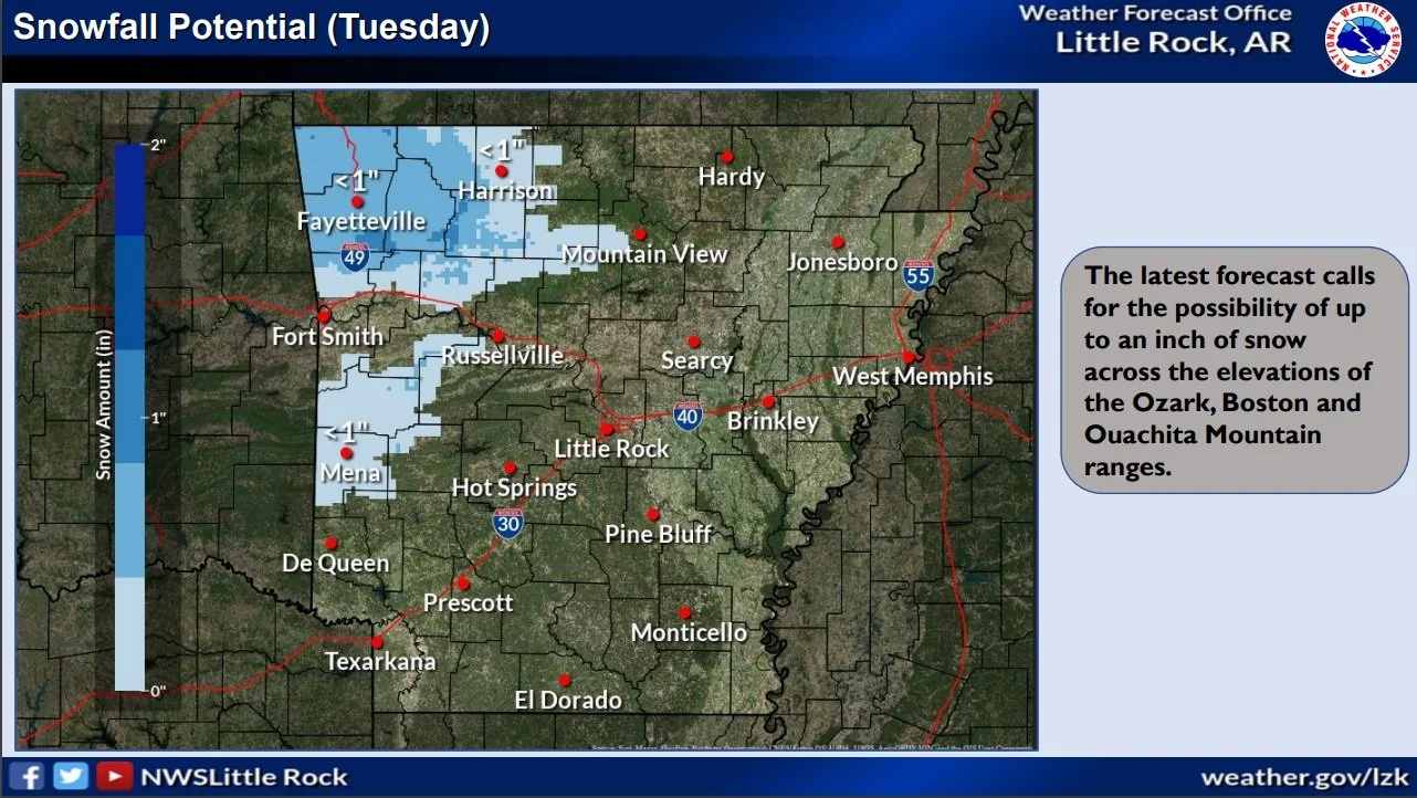
[WHAT] Winter weather conditions, including accumulating snow, mixed sleet and snow, and some freezing rain is forecast over most of the state Tuesday through Wednesday, and will likely result in travel impacts across the state Tuesday through Wednesday.
[WHEN] Winter precipitation is expected to expand in coverage over the state from west to east Tuesday morning (February 18), and persist through Wednesday morning (February 19).
[WHERE] Accumulating snowfall is expected across the northern third of the state, with a transition zone of mixed precipitation and freezing rain more likely through the event over the southern two-thirds of the state.
[ADDITIONAL INFO] Portions of the Winter Storm Watch have been upgraded to a Warning as of Monday morning, highlighting where forecast confidence is highest for impactful snowfall. Changes to the watch area and forecast snowfall amounts are still possible.
Winter Weather Advisories should also be expected where lesser snow amounts and higher ice accruals are forecast.
Hazardous cold is forecast through the latter half of this week, with single digit to negative morning wind chill values possible Wednesday through Friday mornings. Cold Weather Advisories will likely be needed by Wednesday morning.
Snow pictures from De Queen Lake in Southwest Arkansas on January 9th and 10th

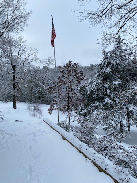
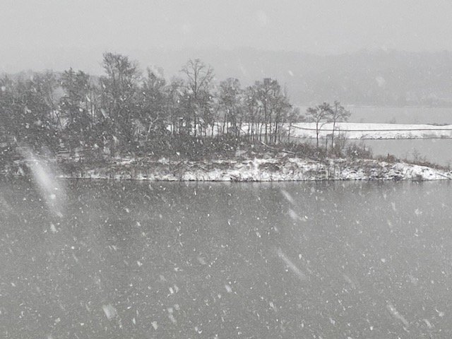
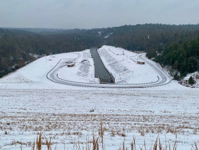
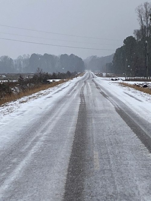


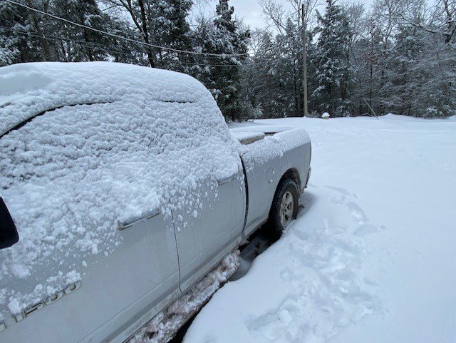
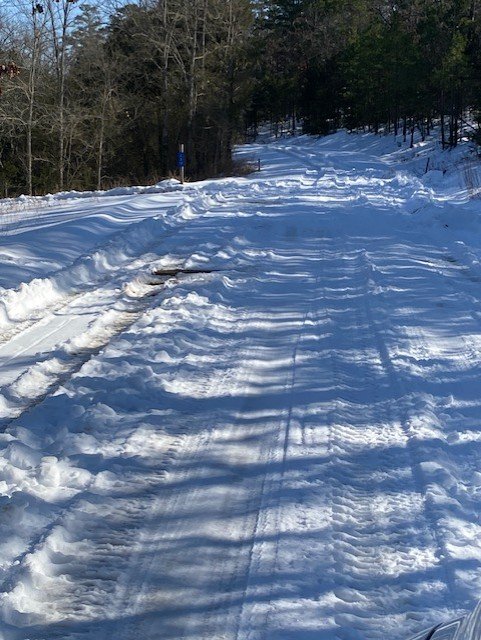
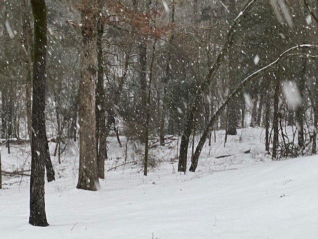
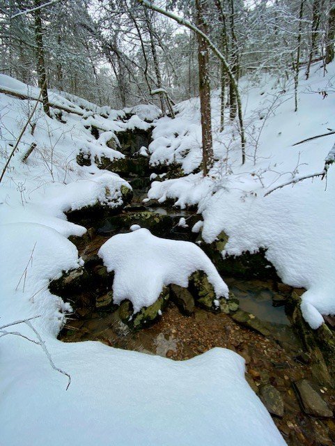
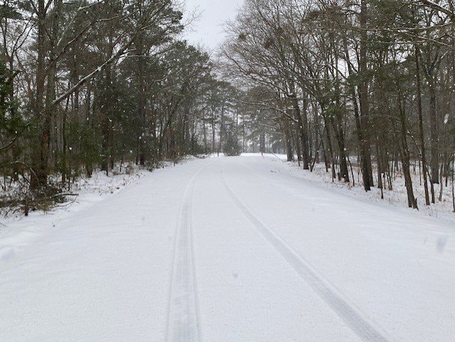
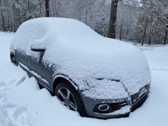
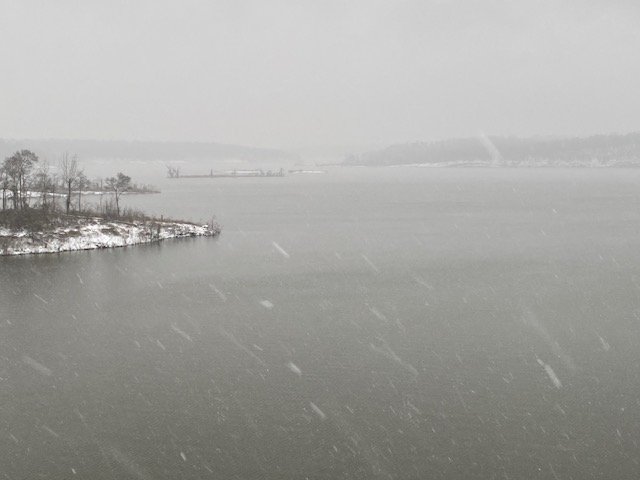
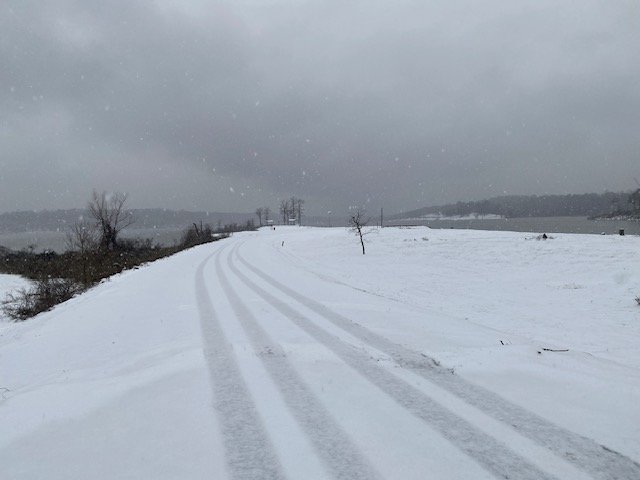
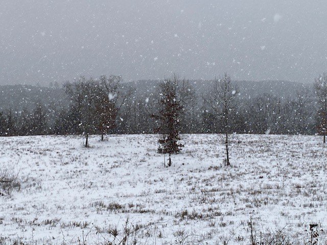
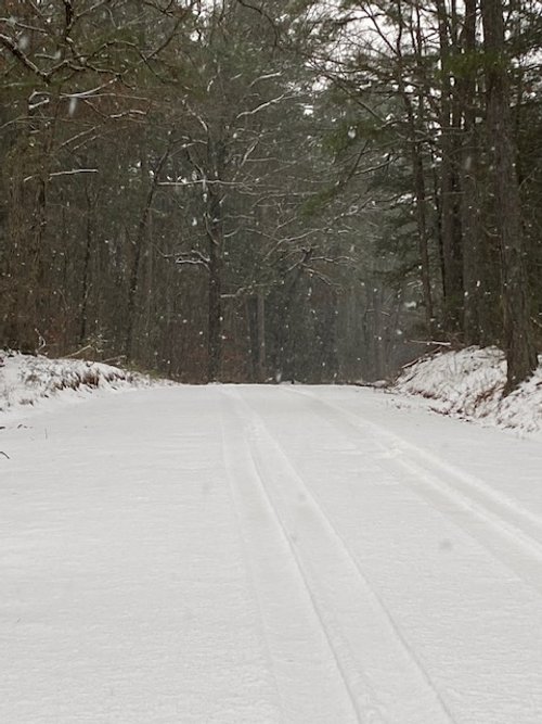
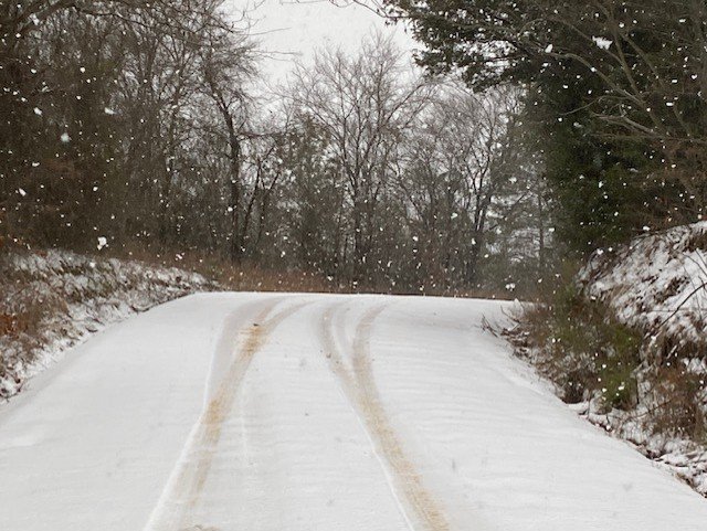
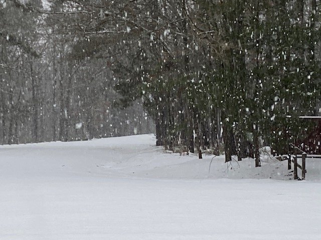
Photo Images by Jon Bunyard
Winter Storm Watch for Arkansas Thursday and Friday

Western to southwestern Arkansas and the Ouachita Mountains is expected to see the greatest snowfall accumulations.
WHAT HAS CHANGED: • Forecast liquid-equivalent (QPF) was increased across the forecast area, which has increased forecast snowfall amounts. • A Winter Storm Watch has been issued across portions of western, southwestern, and central Arkansas, following the areas of highest confidence for winter weather impacts Thursday through Friday (January 9-10).
WHAT WE KNOW: • A strong storm system is forecast to move across the southern Gulf Coast Thursday through Friday, and is expected to bring impactful winter weather to the state. • Greatest confidence for impacts remains across western to southwestern Arkansas.
WHAT WE DON’T KNOW: • There is still uncertainty regarding the exact placement of where the greatest snowfall amounts could occur. This will be addressed over the next few runs of forecast data. • There is also uncertainty across the Arkansas/Louisiana border region with regard to mixed precip types (freezing rain versus wintry mix). Expect changes and refinement to the forecast!
Confidence continues to increase on an impactful winter storm across the state during the Thursday-Friday timeframe (January 9-10). New updates with this briefing include the issuance of a Winter Storm Watch for a large portion of the state.
The greatest impacts are currently expected across western to southwestern, and portions of central Arkansas. Expect changes to the footprint of greatest snowfall accumulations, and the Winter Storm Watch!
Arkansas Weather Briefing from the National Weather Service in Little Rock
There are two storm systems that will impact Arkansas this week. One system will be here today and Tuesday (January 8-9), with another system arriving from the west later Thursday and Friday (January 11-12).
The former system will be primarily a rainmaker, and there will be some rumbles of thunder in places. One to two inches of rain are in the forecast. Any severe weather will remain along the Gulf Coast. As colder air wraps around the departing storm, some light snow could occur over parts of northwest Arkansas (mainly the Boston and Ozark Mountains) on Tuesday. Wind gusts of 30 to 40 mph will be common Monday and Tuesday. The higher terrain over northwest Arkansas could have gusts up to 50 mph.
The latter system will be much like the former system; mostly rain is in the forecast. At this point, there is a potential for severe storms in southern Arkansas. Light snow will likely follow the system in northern sections of the state. There will be a lot of wind as well.
By the weekend/early next week, Arctic air will surge into the region from the northwest. This will result in below to much below average temperatures.
Once cold air is in place, it appears that wintry precipitation will become more likely early next week as storm systems continue arriving from the west/southwest.

UA Cossatot Campuses Will Be Closed Again Tuesday Because of Winter Weather and Hazardous Road Conditions
“Due to the extremely dangerous road conditions all UA Cossatot campuses will be closed on Tuesday, February 16th. We will continue to watch the next winter storm expected to arrive late Tuesday, Wednesday, and Thursday as this may warrant more closures later in the week.”
Dr. Steve Cole
Chancellor
UA Cossatot

Photo of De Queen Lake Road Above Spillway Monday Morning - by Jon Bunyard
7 1/2 Inches of Snow Fell Overnight Sunday Night/Monday Morning in the De Queen Area of Southwest Arkansas

Photo by Jon Bunyard Monday Morning near De Queen Lake