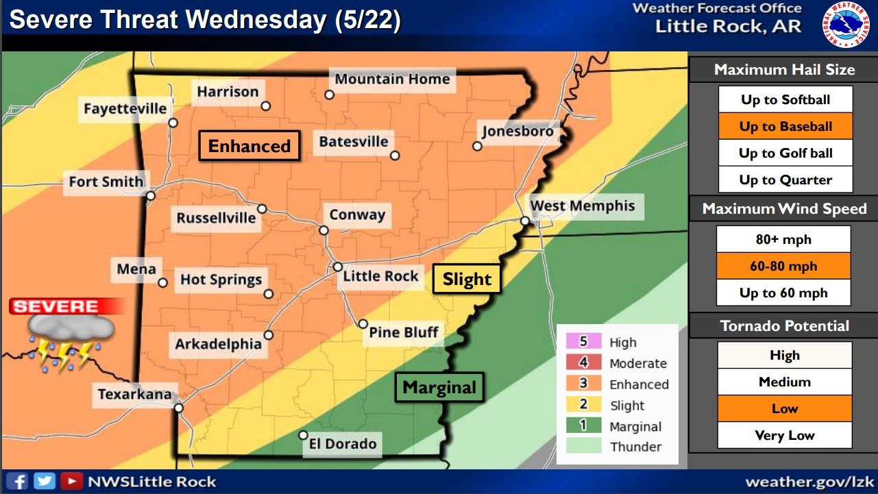
Severe Threat for Arkansas Late This Afternoon and Tonight - (National Weather Service/Little Rock Graph)
An active weather pattern will develop starting late this afternoon and evening as a cold front drops southeast towards Arkansas.
Chances for severe weather will increase starting late this evening into the overnight hours across far northwest sections of Arkansas. This threat will spread further southeast for Wednesday, and continue for a large portion of the state on Thursday.
The primary threats expected with the strongest storms through tonight will be large hail and damaging winds, with a brief tornado or two possible. Very large hail and damaging winds will be the primary threats on Wednesday, with a few tornadoes also possible. Large hail and damaging winds will again be primary threats for Thursday.
There is some uncertainty regarding the severe threat on Wednesday as timing of morning thunderstorms may create less instability for afternoon thunderstorm development.
Some areas of heavy rainfall could be seen by late this week. Rainfall amounts exceeding 3 inches could be seen from late tonight through Friday morning. This may lead to some isolated flash flooding.