


Photos by Jon Bunyard - Ed 88

Photos by Jon Bunyard - Ed 88

The Winter Storm Warning for Southwest Arkansas has expired and the National Weather Service says we can expect a slow warming trend for the next several days with high temperatures back up into the lower 60’s for the middle part of next week.
Governor Asa Hutchinson provided today's update on Arkansas's COVID-19 response.
In its Wednesday update, the Arkansas Department of Health reported 667 new cases; 8,239 active cases; 602 hospitalized, which is down 36 from Tuesday; 108 on ventilators, which is down 2 from Tuesday; deaths added today, 26, for a total of 5,313; a total of 314,192 cases; 238,810 recoveries; PCR tests, 1,152; antigen tests, 929.
The Health Department reported that the top counties for new cases are Garland, 100; Benton, 90; Washington, 86; Sebastian, 59; and Pulaski, 47.
Governor Hutchinson released the following statement on today’s COVID-19 numbers:
"We once again saw a decrease in testing yesterday, which was impacted by the weather. We received an additional 18,525 vaccine doses yesterday, and we will continue to administer these doses as quickly as possible. Please continue to take necessary precautions against COVID-19 and limit road travel as much as possible."
Here are today's COVID-19 statewide numbers:

Here are today's COVID-19 vaccine statewide numbers:

COVID-19 Metrics for Sevier County
Total Active Cases: 79
Active Confirmed Cases: 34
Active Probable Cases: 45
COVID-19 Metrics for Howard County
Total Active Cases: 50
Active Confirmed Cases: 18
Active Probable Cases: 32
COVID-19 Metrics for Little River County
Total Active Cases: 20
Active Confirmed Cases: 10
Active Probable Cases: 10
COVID-19 Metrics for Polk County
Total Active Cases: 66
Active Confirmed Cases: 41
Active Probable Cases: 25
COVID-19 Metrics for Pike County
Total Active Cases: 27
Active Confirmed Cases: 11
Active Probable Cases: 16

Snow-covered Road near De Queen Lake Wednesday morning, 02/17/21 - Photo by Jon Bunyard
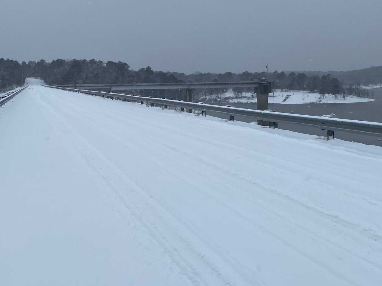
De Queen Lake Road at De Queen Dam Wednesday Morning, 02/17/21 - Photo by Jon Bunyard
COVID-19 Metrics for Sevier County
Total Active Cases: 89
Active Confirmed Cases: 37
Active Probable Cases: 52
COVID-19 Metrics for Howard County
Total Active Cases: 54
Active Confirmed Cases: 20
Active Probable Cases: 34
COVID-19 Metrics for Little River County
Total Active Cases: 25
Active Confirmed Cases: 11
Active Probable Cases: 14
COVID-19 Metrics for Polk County
Total Active Cases: 74
Active Confirmed Cases: 47
Active Probable Cases: 27
COVID-19 Metrics for Pike County
Total Active Cases: 25
Active Confirmed Cases: 13
Active Probable Cases: 12


...Conditions to Deteriorate as Winter Storm Approaches...

.A significant winter storm producing a mix of snow, sleet, and
freezing rain to threaten the region today and not totally ending
until during the day Thursday. Wintry precipitation is expected
to be primarily snow along and north of Interstate 30, a mix of
snow, sleet and freezing rain around the Interstate 20 corridor,
and primarily freezing rain over Deep East Texas and Central
Louisiana. Power outages will be a risk in all areas, but
especially where freezing rain will be predominant. Of course
travel remains difficult in most of the region and any recent
improvement will be lost once this new event sets in. Temperatures
will not be nearly as cold as the last 24 hours, but will remain
well below normal.

...WINTER STORM WARNING REMAINS IN EFFECT UNTIL NOON CST
THURSDAY...

* WHAT...Heavy mixed precipitation expected. Total snow
  accumulations of up to 6 inches across southwest Arkansas and
  ice accumulations of around one half of an inch south of I-20.

* WHERE...Portions of north central and northwest Louisiana,
  southeast Oklahoma, south central and southwest Arkansas and
  east and northeast Texas.

* WHEN...Until noon CST Thursday.

* IMPACTS...Power outages and tree damage are likely due to the
  ice. Travel could be nearly impossible. The hazardous
  conditions could impact the morning or evening commute.

PRECAUTIONARY/PREPAREDNESS ACTIONS...

If you must travel, keep an extra flashlight, food, and water in
your vehicle in case of an emergency.

The latest road conditions for the state you are calling from can
be obtained by calling 5 1 1.
Today
Snow. High near 28. Wind chill values as low as 10. East wind around 5 mph. Chance of precipitation is 80%. Total daytime snow accumulation of 2 to 4 inches possible.
Tonight
A slight chance of snow, mixing with sleet after 9pm, then gradually ending. Cloudy, with a low around 22. Northeast wind around 5 mph. Chance of precipitation is 20%.
Thursday
Mostly cloudy, with a high near 32. North wind 5 to 10 mph.
Thursday Night
Partly cloudy, with a low around 10. North wind around 5 mph.
Friday
Sunny, with a high near 37. Calm wind becoming southwest around 5 mph in the afternoon.
Friday Night
Partly cloudy, with a low around 17.
Saturday
Mostly sunny, with a high near 44.
Saturday Night
Mostly cloudy, with a low around 33.
Sunday
A 20 percent chance of showers after noon. Mostly cloudy, with a high near 50.
Sunday Night
A 20 percent chance of showers before midnight. Partly cloudy, with a low around 29.
Monday
Sunny, with a high near 56.
Monday Night
Mostly clear, with a low around 31.
Tuesday
Sunny, with a high near 61.


“Due to the continuing dangerous road conditions in the area and the possibility of another extended winter storm all UA Cossatot campuses will be closed for the rest of this week (Wednesday, February 16th, Thursday, February 17th, and Friday, February 18th). UA Cossatot fully expects to be open under normal hours on Monday, February 22nd.”
Dr. Steve Cole
Chancellor
UA Cossatot

...Next winter storm will push into our area tonight and
continue through Thursday morning...

...WINTER STORM WARNING REMAINS IN EFFECT FROM 6 PM THIS EVENING
TO NOON CST THURSDAY...
...WIND CHILL ADVISORY IS CANCELLED...

* WHAT...A wintry mix of snow, sleet, and freezing rain. Snow and
  sleet accumulations will range from less than 2 inches south of
  the I-20 corridor to 5 to 8 inches north of the I-30 corridor.
  Ice accumulations of a quarter of an inch to a half of an inch
  with localized higher amounts will be possible from Deep East
  Texas across northwestern Louisiana, central Louisiana, and into
  south- central Arkansas.

* WHERE...Portions of north central and northwest Louisiana,
  southeast Oklahoma, south central and southwest Arkansas and
  east and northeast Texas.

* WHEN...From 6 PM this evening to noon CST Thursday.

* IMPACTS...Treacherous road conditions will continue across the
  region. Locations with over a quarter inch of ice will see
  downed limbs and powerlines which will lead to the possibility
  of widespread power outages. Cold temperatures will continue to
  make extended time outdoors dangerous with the risk of
  hypothermia.

PRECAUTIONARY/PREPAREDNESS ACTIONS...

If you must travel, keep an extra flashlight, food, and water in
your vehicle in case of an emergency.

The latest road conditions for the state you are calling from can
be obtained by calling 5 1 1.
Tonight
Snow, mainly after 9pm. Low around 18. Wind chill values as low as 10. Southeast wind around 5 mph. Chance of precipitation is 80%. New snow accumulation of 1 to 3 inches possible.
Wednesday
Snow before noon, then snow, freezing rain, and sleet. High near 28. Wind chill values as low as 9. Northeast wind around 5 mph. Chance of precipitation is 90%. Little or no ice accumulation expected. New snow and sleet accumulation of 3 to 5 inches possible.
Wednesday Night
A slight chance of snow showers and freezing rain before midnight. Cloudy, with a low around 21. Northeast wind around 5 mph. Chance of precipitation is 20%.
Thursday
Mostly cloudy, with a high near 37. North wind 5 to 10 mph.
Thursday Night
Partly cloudy, with a low around 11.
Friday
Sunny, with a high near 38.
Friday Night
Partly cloudy, with a low around 17.
Saturday
Mostly sunny, with a high near 44.
Saturday Night
Mostly cloudy, with a low around 33.
Sunday
A 30 percent chance of showers. Mostly cloudy, with a high near 52.
Sunday Night
A 30 percent chance of showers. Mostly cloudy, with a low around 32.
Monday
Mostly sunny, with a high near 57.
...HARD FREEZE WARNING REMAINS IN EFFECT UNTIL 6 AM CST TUESDAY...

* WHAT...Sub-freezing temperatures to fall into the single digits
  tonight.

* WHERE...Portions of north central and northwest Louisiana, south
  central and southwest Arkansas, and portions of east Texas.

* WHEN...Through 6 AM CST Tuesday.

* IMPACTS...Hard freeze conditions will kill crops, other
  sensitive vegetation and damage unprotected outdoor plumbing.

PRECAUTIONARY/PREPAREDNESS ACTIONS...

Take steps now to protect tender plants from the cold. To prevent
freezing and possible bursting of outdoor water pipes they should
be wrapped, drained, or allowed to drip slowly. Those that have
in-ground sprinkler systems should drain them and cover above-
ground pipes to protect them from freezing.
Tonight
Partly cloudy, with a low around 1. Northwest wind around 5 mph becoming calm in the evening.
Tuesday
Increasing clouds, with a high near 26. Wind chill values as low as 1. Calm wind becoming southeast around 5 mph in the afternoon.
Tuesday Night
A chance of snow showers before midnight, then snow and sleet likely. Cloudy, with a low around 19. Wind chill values as low as 11. East wind around 5 mph. Chance of precipitation is 70%.
Wednesday
Snow showers before noon, then snow showers, freezing rain, and sleet. The snow could be heavy at times. High near 29. Northeast wind 5 to 10 mph. Chance of precipitation is 100%.
Wednesday Night
Snow showers, freezing rain, and sleet likely before midnight, then a chance of snow showers. Cloudy, with a low around 23. Chance of precipitation is 60%.
Thursday
A 40 percent chance of snow showers, mainly before noon. Mostly cloudy, with a high near 33.
Thursday Night
Partly cloudy, with a low around 10.
Friday
Sunny, with a high near 38.
Friday Night
Partly cloudy, with a low around 18.
Saturday
Mostly sunny, with a high near 46.
Saturday Night
Mostly cloudy, with a low around 35.
Sunday
Mostly cloudy, with a high near 53.
“Due to the extremely dangerous road conditions all UA Cossatot campuses will be closed on Tuesday, February 16th. We will continue to watch the next winter storm expected to arrive late Tuesday, Wednesday, and Thursday as this may warrant more closures later in the week.”
Dr. Steve Cole
Chancellor
UA Cossatot

Photo of De Queen Lake Road Above Spillway Monday Morning - by Jon Bunyard

Photo by Jon Bunyard Monday Morning near De Queen Lake

Snow Picture of the Leeper Building at UA Cossatot De Queen Sunday Morning 02/14/21
"Due to the expected storm conditions expected this weekend and to start the work week, all UA Cossatot campuses will be closed Monday, February 15th." Dr. Steve Cole, Chancellor, UA Cossatot

Click on photo above for the Winter Weather Briefing from the National Weather Service.
Sevier-Howard-Little River-Hempstead-Nevada-Miller-Lafayette- Columbia-Union-Caddo-Bossier-Webster-Claiborne-Lincoln-De Soto- Red River-Bienville-Jackson-Ouachita-Sabine-Natchitoches-Winn- Grant-Caldwell-La Salle-McCurtain-Bowie-Franklin-Titus-Camp- Morris-Cass-Wood-Upshur-Marion-Smith-Gregg-Harrison-Cherokee-Rusk- Panola-Nacogdoches-Shelby-Angelina-San Augustine- Including the cities of De Queen, Nashville, Mineral Springs, Dierks, Ashdown, Hope, Prescott, Texarkana, Stamps, Lewisville, Bradley, Magnolia, El Dorado, Shreveport, Bossier City, Minden, Springhill, Homer, Haynesville, Ruston, Farmerville, Bernice, Mansfield, Stonewall, Logansport, Coushatta, Martin, Arcadia, Ringgold, Gibsland, Jonesboro, Monroe, Many, Zwolle, Pleasant Hill, Natchitoches, Winnfield, Colfax, Montgomery, Dry Prong, Clarks, Grayson, Columbia, Jena, Midway, Olla, Idabel, Broken Bow, Clarksville, Bogata, Mount Vernon, Mount Pleasant, Pittsburg, Daingerfield, Lone Star, Naples, Omaha, Atlanta, Linden, Hughes Springs, Queen City, Mineola, Winnsboro, Quitman, Hawkins, Gilmer, Big Sandy, Jefferson, Tyler, Longview, Marshall, Jacksonville, Rusk, Henderson, Carthage, Nacogdoches, Center, Lufkin, San Augustine, Hemphill, and Pineland 223 AM CST Sun Feb 14 2021

* WHAT...For the Winter Storm Warning, heavy mixed precipitation expected. Total snow accumulations of 3 to 5 inches possible across deep east Texas into northwest Louisiana and south- central Arkansas with lesser amounts elsewhere. Sleet accumulations of around 1 inch and ice accumulations of around one quarter of an inch possible across north-central and northeast Louisiana. For the Wind Chill Advisory, very cold wind chills expected. Wind chills as low as 5 below zero across southeast Oklahoma and in the single digits elsewhere.
* WHERE...Portions of north central and northwest Louisiana, southeast Oklahoma, south central and southwest Arkansas and east and northeast Texas.
* WHEN...For the Winter Storm Warning, through 6 PM CST Monday. For the Wind Chill Advisory, through 6 PM CST Monday.
* IMPACTS...Power outages and tree damage are likely due to the ice. Travel could be nearly impossible due to snow, sleet, and ice accumulations. The cold wind chills could result in hypothermia if precautions are not taken.
PRECAUTIONARY/PREPAREDNESS ACTIONS... If you must travel, keep an extra flashlight, food, and water in your vehicle in case of an emergency. Use caution while traveling outside. Wear appropriate clothing, a hat, and gloves. The latest road conditions for the state you are calling from can be obtained by calling 5 1 1.
* WHAT...Sub-freezing temperatures on Sunday night to range anywhere from single digits across Southeast Oklahoma to near 20 degrees across East Texas and North-Central Louisiana. On Monday night, temperatures are forecast to fall into the single digits areawide.
* WHERE...Portions of north central and northwest Louisiana, southeast Oklahoma, south central and southwest Arkansas and east and northeast Texas.
* WHEN...From midnight tonight to 6 AM CST Tuesday.
* IMPACTS...Hard freeze conditions will kill crops, other sensitive vegetation and possibly damage unprotected outdoor plumbing.
PRECAUTIONARY/PREPAREDNESS ACTIONS... Take steps now to protect tender plants from the cold. To prevent freezing and possible bursting of outdoor water pipes they should be wrapped, drained, or allowed to drip slowly. Those that have in-ground sprinkler systems should drain them and cover above- ground pipes to protect them from freezing.
Sunday
Snow likely before noon, then snow and sleet likely between noon and 3pm, then snow likely after 3pm. Cloudy, with a high near 26. Wind chill values as low as 11. Northeast wind around 10 mph. Chance of precipitation is 60%. Total daytime snow and sleet accumulation of less than a half inch possible.
Sunday Night
Snow. Low around 11. Wind chill values as low as 4. North wind 5 to 10 mph. Chance of precipitation is 90%. New snow accumulation of 3 to 5 inches possible.
Monday President’s Day
A 20 percent chance of snow before noon. Partly sunny and cold, with a high near 22. Wind chill values as low as zero. North wind 5 to 10 mph.
Monday Night
Partly cloudy, with a low around 3. Northwest wind around 5 mph becoming calm in the evening.
Tuesday
Partly sunny, with a high near 29. Calm wind becoming southeast around 5 mph in the afternoon.
Tuesday Night
A slight chance of snow showers before midnight, then a chance of snow and freezing rain. Cloudy, with a low around 19. Chance of precipitation is 50%.
Wednesday
Snow and sleet before noon, then snow and freezing rain. High near 28. Chance of precipitation is 90%.
Wednesday Night
Snow, freezing rain, and sleet likely, mainly before midnight. Cloudy, with a low around 24. Chance of precipitation is 60%.
Thursday
A 30 percent chance of snow showers, mainly before noon. Mostly cloudy, with a high near 34.
Thursday Night
Partly cloudy, with a low around 10.
Friday
Sunny, with a high near 39.
Friday Night
Partly cloudy, with a low around 22.
Saturday
Mostly sunny, with a high near 48.
PRESS RELEASE
183 College Drive, De Queen, AR 71832
870-584-1124
www.cccua.edu
FOR IMMEDIATE RELEASE: 12 February 2021
CONTACT: Ben Renfrow, Marketing Coordinator
The first annual FRIENDS Foundation meeting took place on Friday, February 5, 2021, at 11:30 A.M. at the De Queen Herman Dierks Park community building. FRIENDS is a foundation that was established to help Sevier County grow through economic development projects and activities. Twenty-eight people attended the meeting, and five attended via zoom.
The history of FRIENDS and the Sevier County Economic Development department was discussed during the meeting. Membership and funding progress toward the annual budget was also covered. The meeting concluded with the election of the 2021 FRIENDS Foundation Board of Directors.
The FRIENDS Foundation Board of Directors includes President Mike Branson, Vice-President Greg Revels, Secretary/Treasurer Jay Bunyard, Dr. Steve Cole, Jimmy Bristow, Angie Walker, and Ned Hendrix.
Jeff Tollett and Dion Cooper from REA were invited to the meeting as special guests to announce to the foundation members that REA has plans to enter broadband service in our community and answered questions about that process.
The FRIENDS Board of Directors had its first directors’ meeting on Friday, February 12, 2021, at UA Cossatot’s De Queen Campus in the Weyerhaeuser room at 11:30 A.M. At the meeting, they met with a hotel developer to gain insights on hospitality conditions since the pandemic hit. They also discussed leadership training opportunities for our community to consider.
All individuals of Sevier County are encouraged and welcome to join FRIENDS. Membership for the year is granted with any donation of $100 or more. For any questions about the Sevier County FRIENDS
Foundation, please contact Sevier County Economic Development Director Tiffany Maurer at tmaurer@cccua.edu or 870-584-1184.###
LITTLE ROCK – Governor Asa Hutchinson provided today's update on Arkansas's COVID-19 response.
In its Thursday update, the Arkansas Department of Health reported 1,103 new cases; 13,518 active cases; 712 hospitalized, which is down 23 from Wednesday; 117 on ventilators, which is down 21 from Wednesday; deaths added today, 25, for a total of 5,199; a total of 311, 043 cases; 233,057 recoveries; PCR tests, 11,617; antigen tests, 1,470.
The Health Department reported that the top counties for new cases are Pulaski, 178; Benton, 90; Washington, 60; Saline, 57; and Sebastian, 52
Governor Hutchinson released the following statement on today’s COVID-19 numbers:
"For the second day in a row, we see a decrease of over 50% in new cases from last week. Vaccine administration has progressed throughout the state, with an increase of over 94,000 since last week. We must continue doing our part in this fight."
Here are today's COVID-19 statewide numbers:

Here are today's COVID-19 vaccine statewide numbers:

COVID-19 Metrics for Sevier County
Total Active Cases: 132
Active Confirmed Cases: 41
Active Probable Cases: 91
COVID-19 Metrics for Howard County
Total Active Cases: 84
Active Confirmed Cases: 32
Active Probable Cases: 52
COVID-19 Metrics for Little River County
Total Active Cases: 37
Active Confirmed Cases: 16
Active Probable Cases: 21
COVID-19 Metrics for Polk County
Total Active Cases: 102
Active Confirmed Cases: 65
Active Probable Cases: 37
COVID-19 Metrics for Pike County
Total Active Cases: 30
Active Confirmed Cases: 20
Active Probable Cases: 10

Callie Miller, De Queen / Sevier County Chamber of Commerce President, was a guest on the Ed 88 Morning Show Thursday and announced new chamber board members and discusssed some planned spring events.
LITTLE ROCK – Governor Asa Hutchinson provided today's update on Arkansas's COVID-19 response.
In its Wednesday update, the Arkansas Department of Health reported 1,092 new cases; 14,190 active cases; 735 hospitalized, which is down 40 from Tuesday; 138 on ventilators, which is up 1 from Tuesday; deaths added today, 26, for a total of 5,174; a total of 309,940 cases; 231,828 recoveries; PCR tests, 7,790; antigen tests, 2,207.
The Health Department reported that the top counties for new cases are Pulaski, 163; Washington, 85; Benton, 71; Saline, 68; and Faulkner, 56.
Governor Hutchinson released the following statement on today’s COVID-19 numbers:
"Compared to last week, there are over 1,300 fewer new cases and over 2,300 fewer active cases. Our mitigation efforts are working, but we cannot use this as an excuse to relax. This virus can spread rapidly, and we all must work together to defeat it."
Here are today's COVID-19 statewide numbers:

Here are today's COVID-19 vaccine statewide numbers:


COVID-19 Metrics for Sevier County
Total Active Cases: 123
Active Confirmed Cases: 39
Active Probable Cases: 84
COVID-19 Metrics for Howard County
Total Active Cases: 90
Active Confirmed Cases: 34
Active Probable Cases: 56
COVID-19 Metrics for Little River County
Total Active Cases: 40
Active Confirmed Cases: 18
Active Probable Cases: 22
COVID-19 Metrics for Polk County
Total Active Cases: 94
Active Confirmed Cases: 62
Active Probable Cases: 32
COVID-19 Metrics for Pike County
Total Active Cases: 31
Active Confirmed Cases: 21
Active Probable Cases: 10