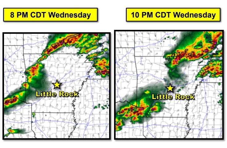
A few strong to severe thunderstorms are possible across western Arkansas Wednesday evening and Wednesday night.
Scattered showers and thunderstorms will be possible today across the region into this evening. Late tonight, strong to severe thunderstorms will be possible mainly northwest of the region. Look for strong south winds today outside thunderstorms with wind gusts upwards of 30 mph possible. There will continue to be an elevated fire threat due to very dry conditions with those conditions continuing until rainfall materializes later today into Thursday.

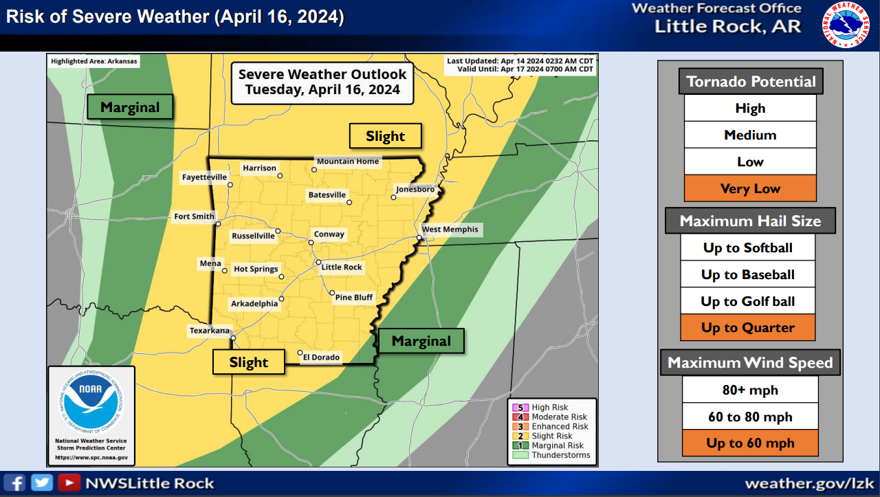
A few strong to severe thunderstorms are possible across eastern and southern Arkansas Thursday.
In SW AR, rain chances will continue through the end of the work week, into the upcoming weekend and into early next week as well. At this time, strong to severe thunderstorms do not appear likely through early next week. Temperatures will remain mostly above normal through the extended period as well.

The forecast for Halloween evening calls for rain chances across the southeast with dry conditions elsewhere. Temperatures will largely be in the 50s and 60s.